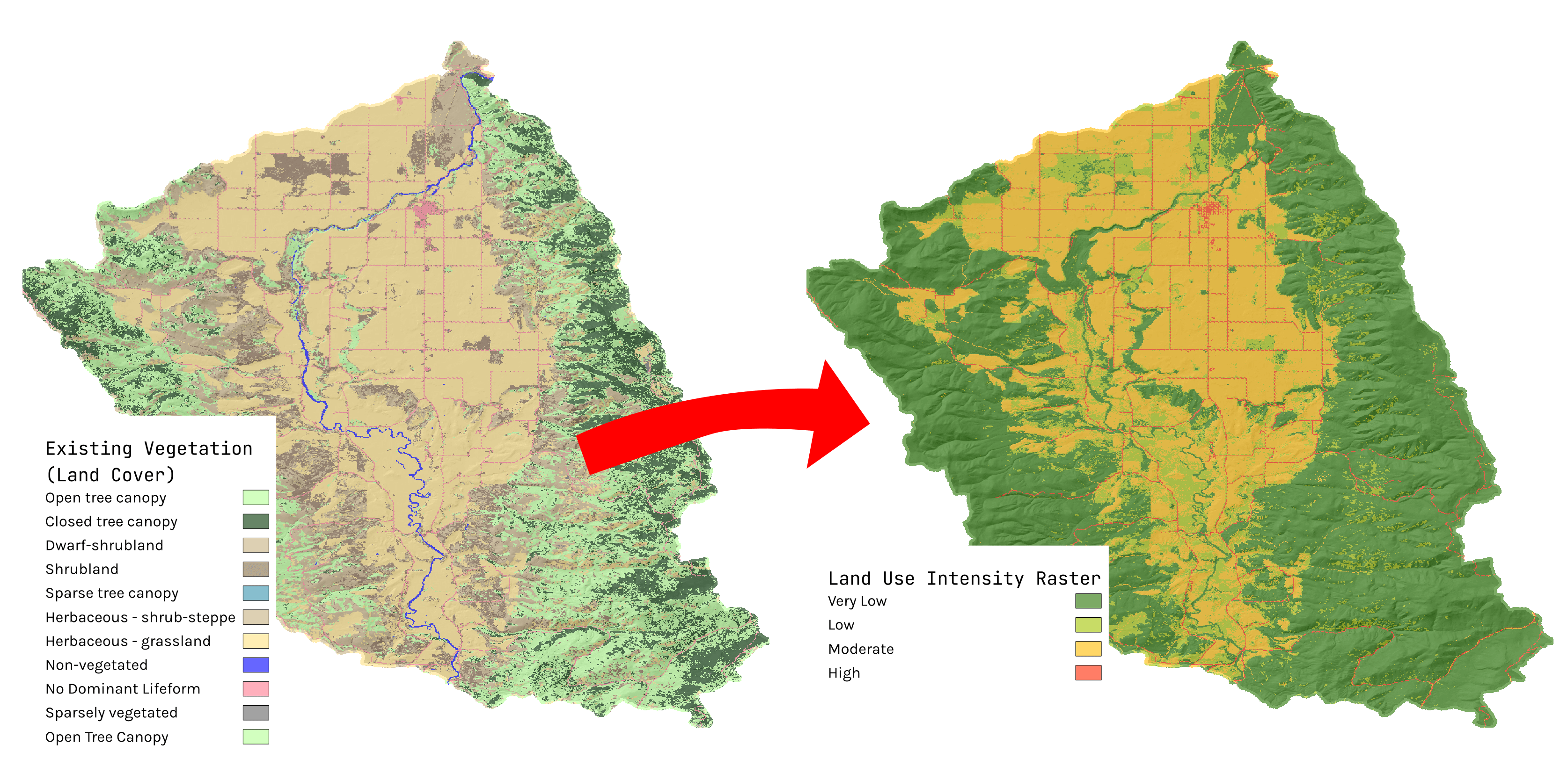
Anthropogenic Context Model Logic
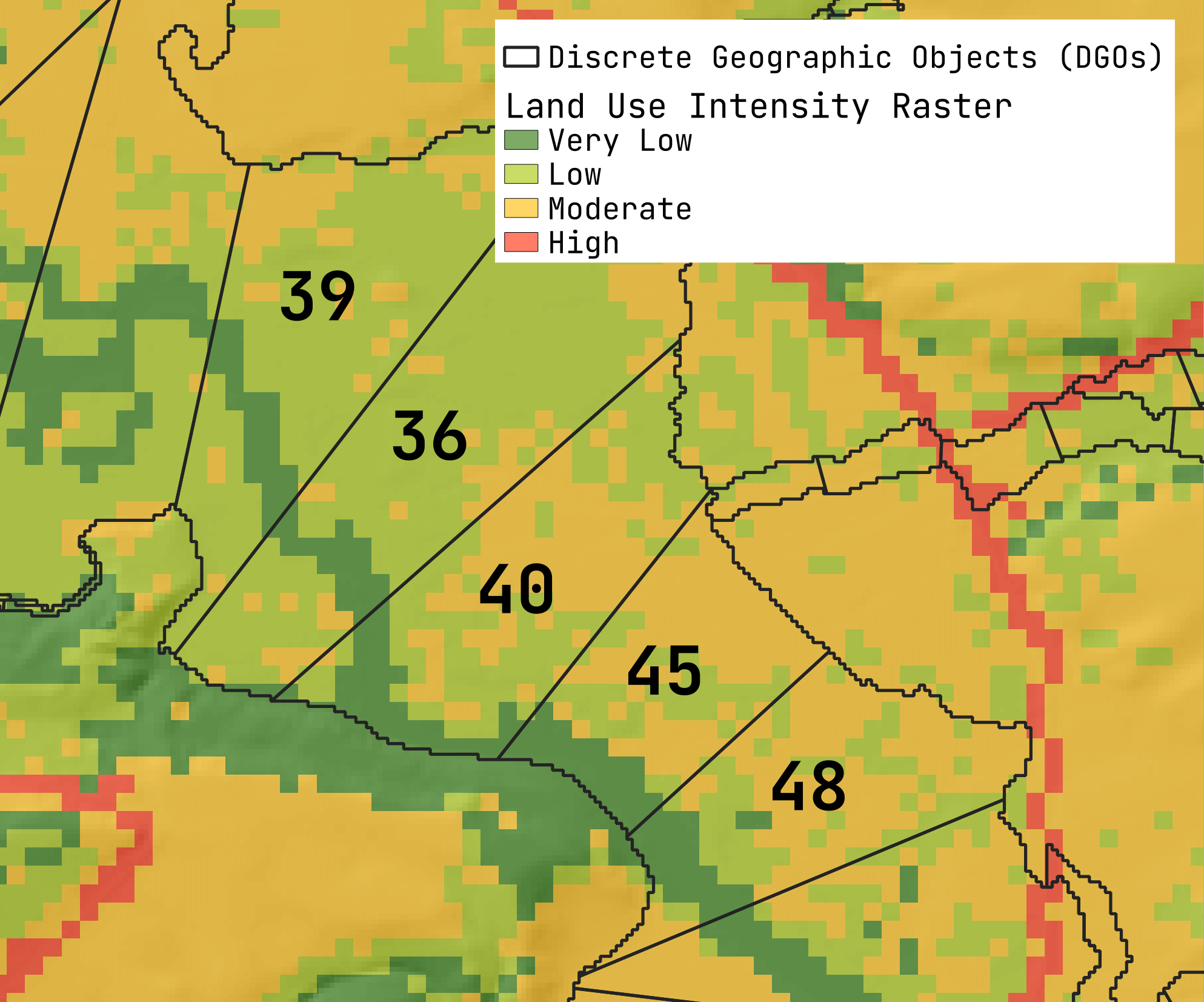
Land Use intensity
Land use intensity is calculated using a simple lookup table that converts land cover types into intensity values. For the land cover raster (using default model inputs, this is the LANDFIRE Existing Vegetation Type), each cell is assigned a land use intensity value based on the lookup table. The possible intensity values are 0 for no land use (i.e., natural vegetation or land cover types that are not considered to be anthropogenic), 33 for low intensity land use (e.g., pastoral or fallowed agriculture), 66 for moderate intensity land use (e.g., row crop agriculture) and 100 for high intensity land use (urban/developed).
To calculate land use intensity values for each reach of the drainage network in the vwReaches output, the land use intensity raster is sampled within a 100m buffer of the reach. The mean intensity value is then calculated for each reach. Similarly to calculate and average land use intensity for DGO and IGO outputs vwDgos vwIgos, the land use intensity raster is sampled within the entire DGO or moving window, and the average value assigned to the DGO/IGO.